This section contains information about the Tarcoola to Alice Springs (TAS) railway section of the standard gauge Central Australian Railway. The railway is 831km in length.
| 12.4.1975 | Prime Minister Gough Whitlam turned the first sod of the new standard gauge railway from Tarcoola to Alice Springs. Locomotive CL9 was named after the Prime Minister at the ceremony. |
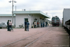
| 19.1980 | New line from Tarcoola to Alice Springs opens on standard gauge to replace the old narrow gauge line via Marree and Oodnadatta. |
| 1997 | Commonwealth leased the Tarcoola to Alice Springs line to AustralAsia Rail Corporation. The AustralAsia Railway Corporation was established in 1997 by the Government of the Northern Territory to build the Darwin - Alice Springs railway. 50% of its board positions and voting right are assigned to the South Australian Government. It owns some of the infrastructure of the Darwin - Alice Springs, Northern Territory railway and the lease of the Alice Springs - Tarcoola, South Australia railway from the Australian Government, and leases (or subleases) them to FreightLink. |
| 2000 | Awarded of contract to build the Darwin - Alice Springs railway to the Asia Pacific Transport Consortium as a Build Own Operate and Transfer back operation. The Australian Government contributed $165 million from the Centenary of Federation Fund, the Northern Territory Government contributed $165 million and the South Australian Government contributed $150 million to the AustralAsia Rail Corporation for the construction of assets by Asia Pacific Transport Consortium and FreightLink that were later leased for a peppercorn rental to FreightLink. In addition, the three Governments contributed about $26 million each, a total of $79 million in further funding to support the Asia Pacific Transport Consortium directly, by way of mezzanine debt financing (subordinated debt), equity and contingent equity.[AustralAsia Railway Corp] |
| 17.9.2003 | Darwin reached |
| 19.5.2008 | Freightlink board, shareholders and lenders agreed to sell its ownership of the Adelaide to Darwin rail link after failing to make a profit since the railway line commenced operation.[Financial Review 19.5.2008] |
| 6.11.2008 | Freightlink goes into voluntary administration after failing to reach agreement with creditors on the terms of a sale of the business.[ Northern Territory News. 7.11.2008] |
| 12 & 15.11.1917 | Tarcoola (No 10) 257 m 20 c - List of Open Stations [NAA B300 5981 Pt 1] |
| 1.5.1924 | Crossing Loop 1500 ft [GA] |
| 30.6.1924 | Tarcoola - Attended ES [Before Annual Report] |
| 1.8.1932 | Sidings in Addition 1410 ft [GA] |
| 12.7.1937 | Tarcoola 314 m - [SAWN 27/37] |
| 1.11.1939 | Tarcoola 313 m 54 c 11l - [Goods and Livestock ] |
| 1.3.1950 | Loop 1500 ft., Siding 1410 ft [GA] |
| 24.9.1953 | Tarcoola 313 m 54 c 11l - Loop 1496 ft [WGC 39/53] |
| 1.1.1961 | Tarcoola 313 m 54 c - Pass. Fares & Goods Rates Books |
| - | Attended Electric Staff Station [List June 1961] |
| - | Tarcoola 313 m 54 c - In Public Timetable 28.3.1918 to March 1994 |
| 26.10.1961 | Loop North side, Extn 1100 ft. East Points now 313 m 23 c 30.10.1961, Completed 6.11.1961, [WN 43/61 ] |
| 25.1.1962 | Tarcoola 313¾m - New West Points at 313 m 74 c 29.1.1962 [WN 4/62 ] |
| 22.2.1962 | Loop now 3102 ft [WN8/62] |
| 1.11.1962 | Tarcoola 313¾m - Train Order replaced Electric Staff Port Augusta - Tarcoola 11.11.1962 [WN][WN 44/62] |
| - | Train Order replaced Electric Staff Tarcoola - Cook 25.11.1962 |
| 14 & 21.2.1963 | Tarcoola 313¾m - Loop now 3060 ft [WN][WN 7 & 8/63] |
| 13.1.1972 | Extension: West xover 314 m 28 c 10ft 18.1.1972 [WN][WN 2/72] |
| 20.1.1972 | Tarcoola 313¾m - Points at 313 m 78 c removed 24.1.1972 [WN][WN 3/72] |
| 2.3.1972 | Points' removal delayed to 31.1.1972 5130ft not 5100ft [WN][WN 9/72] |
| 2.7.1973 | Tarcoola 504.5 km - 504 km in Pass. Fares 1.7.1973, 504.5 km in WTT 14.10.73, Loop 1564 m [Metrication] |
| 17.8.1975 | Station in Fast & slow Mixed Service [Advert] |
| 1.7.1979 | Tarcoola 504.5 km - Resthouse for trainmen - Carriage watering station - Crossing loop 1564 m ANR WTT 1.7.1979 |
| 4.8.1985 | Tarcoola 504.5 km - Loop now 1979 m [WTT] |
| 8.9.1994 | Extensions: East Points now 503.4 km, West Points 505.4 km [sn 35/94] |
| 2.1.2004 | Northgate BP - Defined as Block Location - nil loop - Center 510.850km [ASR Network Operating Guide Pt 32] |
| 2.2001 | Quarry 553.801km - Dead end siding has crossing loop 809 m long [ARTC MAP TA400016] |
| 2.1.2004 | 555 Quarry 555.00km - Defined as Block Location - yard with nil loop - South Yard Location Board 554.650km, Center 555.00km, North Yard Location Board 554.970Km [ASR Network Operating Guide Pt 32] |
| 2.2001 | Carnes - South Switch 562.478km, North Switch 567.421km - Crossing Loop 1849 m [ARTC MAP TA400016] |
| 2.1.2004 | Carnes - Defined as Block Location - Crossing Loop 1840 m length - South Yard Location Board 565.318km, Center 566.50km, North Yard Location Board 567.581Km [ASR Network Operating Guide Pt 32] |
| 2.2001 | Wirrida - South Switch 640.078km, North Switch 642.022km - Crossing Loop 1849 m [ARTC MAP TA400016] |
| 2.1.2004 | Wirrida - Defined as Block Location - Crossing Loop 1841 m length - South Yard Location Board 640.238km, Center 641.00km, North Yard Location Board 642.182Km [ASR Network Operating Guide Pt 32] |
| 2.2001 | Manguri - South Switch 705.537kmkm, North Switch 707.483kmkm - Crossing Loop 1849 m [ARTC MAP TA400016] |
| 2.1.2004 | Manguri - Defined as Block Location - Crossing Loop 1849 m length - South Yard Location Board 705.377km, Center 706.50km, North Yard Location Board 707.643Km [ASR Network Operating Guide Pt 32] |
| 2.1.2004 | Cadney Park - Defined as Block Location - Crossing Loop 1842 m length - South Yard Location Board 829.400km, Center 830.50km, North Yard Location Board 831.658Km [ASR Network Operating Guide Pt 32] |
| 2.1.2004 | Marla - Defined as Block Location - Crossing Loop 1524 m length - South Yard Location Board 907.980km, Center 909.00km, North Yard Location Board 909.926Km [ASR Network Operating Guide Pt 32] |
| 2.1.2004 | Chandler - Defined as Block Location - Crossing Loop 1799 m length - South Yard Location Board 955.343km, Center 965.50km, North Yard Location Board 957.398Km [ASR Network Operating Guide Pt 32] |
| 2.1.2004 | Marryat - Defined as Block Location - Crossing Loop 999 m length - South Yard Location Board 1020.491km, Center 1021.00km, North Yard Location Board 1021.910Km [ASR Network Operating Guide Pt 32] |
| 2.1.2004 | Kulgera - Defined as Block Location - Crossing Loop 1833 m length - South Yard Location Board 1080.398km, Center 1081.50km, North Yard Location Board 1082.646Km [ASR Network Operating Guide Pt 32] |
| 2.1.2004 | Impadna - Defined as Block Location - Crossing Loop 1859 m length - South Yard Location Board 1162.277km, Center 1163.50km, North Yard Location Board 1164.556Km [ASR Network Operating Guide Pt 32] |
| 2.1.2004 | Hugh River - Defined as Block Location - Crossing Loop 1859 m length - South Yard Location Board 1243.395km, Center 1244.50km, North Yard Location Board 1245.667Km [ASR Network Operating Guide Pt 32] |
| 2.1.2004 | Mereenie Siding - Defined as Block Location - yard with nil loop - South Yard Location Board 1312.814km, Center 1313.00km, North Yard Location Board 1313.580Km [ASR Network Operating Guide Pt 32] |
| 2.1.2004 | Roe Creek - Defined as Block Location - Crossing Loop 1888 m length - South Yard Location Board 1317.300km, Center 1318.00km, North Yard Location Board 1319.538Km [ASR Network Operating Guide Pt 32] |
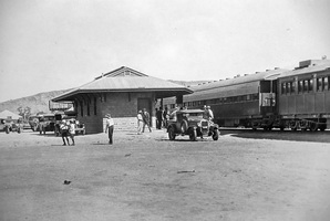
| 11.1934 | Alice Springs 771m narrow gauge [SAR PTT 11.1934] |
| 6.1953 | Alice Springs 771m narrow gauge [SAR PTT 6.1953] |
| 2.1973 | Alice Springs 771m narrow gauge [PTT 2.1973] |
| - | Alice Springs narrow gauge - 771 miles 11 chains |
| 2.1.2004 | Alice Springs - Defined as Block Location - Terminal with nil loop - South Yard Location Board 1334.000km, Center 1335.00km, North Yard Location Board 1338.60Km [ASR Network Operating Guide Pt32] |
